Home
About
Topo Maps of Canada
Topo Map Info
Wall Maps
Ottawa Maps
Custom Cartography
Optics
Special Deals
Contact Us
Shopping Cart
Our Partners....
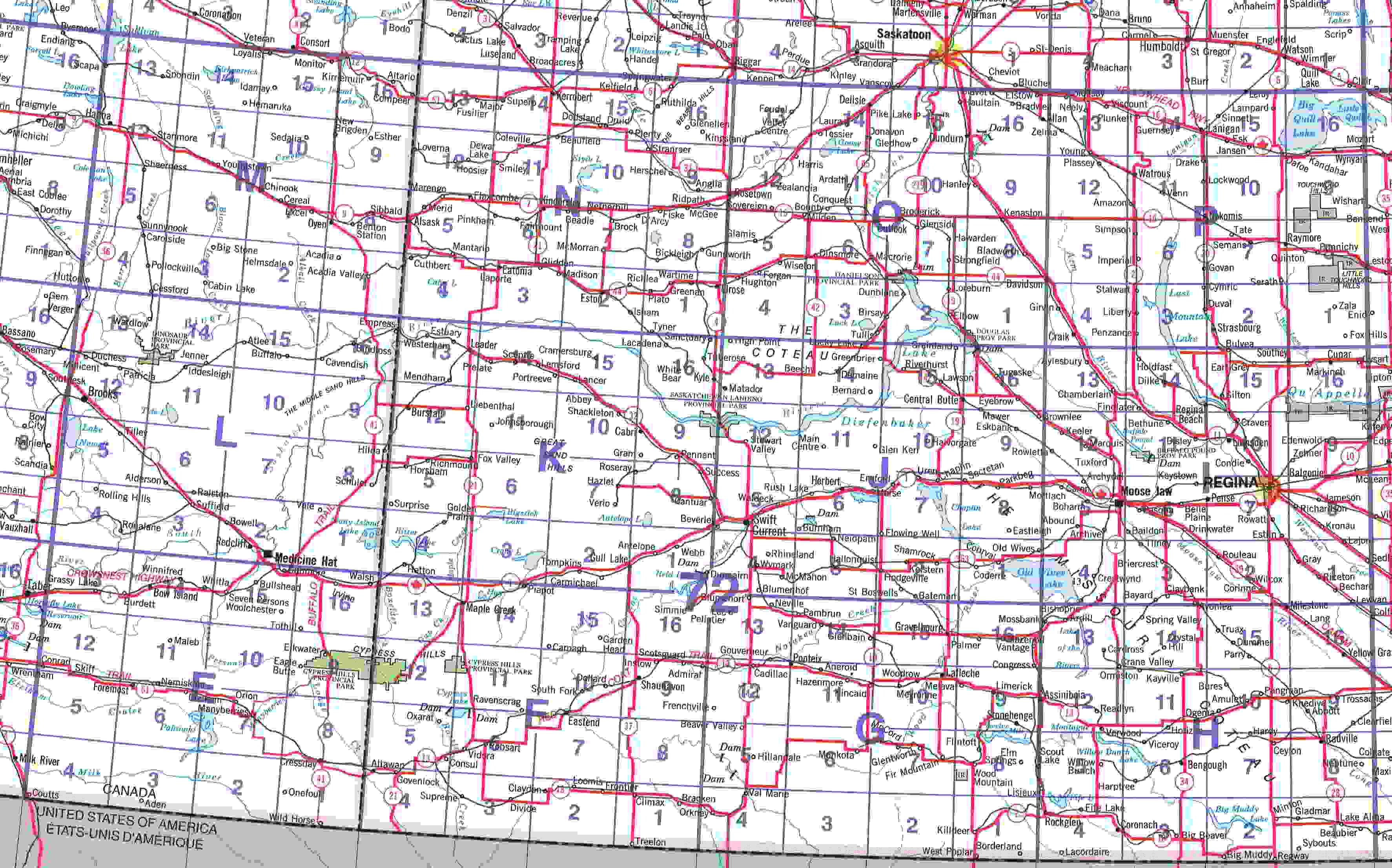
Click here to order from Map 01
Click on the map to enlarge it.