


We are a Certified Map Printer for NRCan providing print on demand service for Canadian Mapping
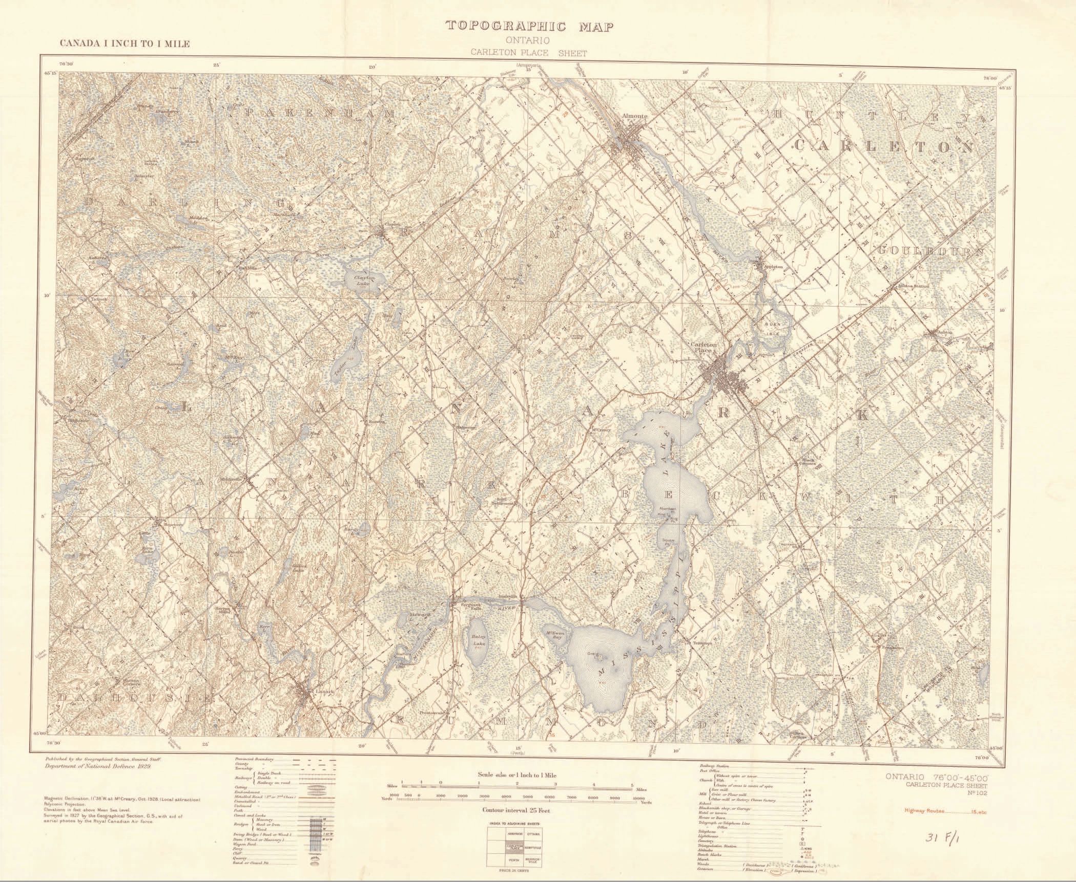
The 1:50 000 scale topographic map is a detailed depiction of the land area covered. This scale is ideal for recreational activities. Maps at this scale are used by all levels of government and industry for flood control, forest fire control, real estate planning, development of natural resources, environmental issues, rights-of-way, highway planning and depiction of crop areas.
Accurately shown are hills, valleys, lakes, rivers, streams, wooded areas; major, secondary and side roads; and all man-made features such as buildings, powerlines, dams and cut lines. A 1:50 000 scale map covers an area approximately 1000 square kilometres. Vast portions of Canada's northern regions are sparsely populated, if at all. Monochrome (black and white) maps have been produced for many of these areas.
The 1:250 000 scale topographic map is considered to be a reconnaissance-type map. It covers the same area of land as 16 1:50 000 scale maps. This scale has gained popularity, not only as a detailed overview of a large area, but also as an excellent road map, for use when traveling on back roads and side roads. A 1:250 000 scale map shows an area approximately the size of Prince Edward Island.
Questions about magnetic declination?
Call us with your questions.